Inks Lake was created in the 1920′s as a means of flood control along the Lower Colorado River. It’s the second of six such lakes that make up the "Highland Lakes Chain" here in central Texas, created by the Buchanan dam to the north and Inks dam to the south. It was built by the Lower Colorado River Authority (LCRA) during the Great Depression and provided employment for 1,500 workers during its construction. The state acquired the land in the 1940′s as part of a public works project sponsored by Lyndon B. Johnson when he was just a US Congressman.
The geology of the area is truly unique with pink, granite-like outcrops called “Valley Spring Gneiss” pushing their way up through the surrounding limestone. These outcrops support a unique ecology of wildflowers, grasses, mosses and even ferns. Inks Lake State Park is a place that you could explore and photograph for years and never run out of interesting sights to see. In the springtime when the wildflowers bloom, the area comes alive with color and that’s why Inks Lake is always one of the stops on the Texas Landscape Safari.
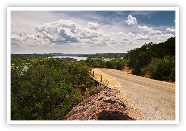
Inks Lake – Burnet, Texas
Copyright 2009 Jeff Lynch Photography
Shot taken with a Canon EOS 50D set on aperture priority (Av) using an EF 24-105mm f/4L IS USM lens tripod-mounted. The exposure was taken at 24mm, f/11 for 1/50th of a second at ISO 100 using a Singh-Ray 2-stop (soft) graduated neutral density filter. All post capture processing was done in Adobe’s Lightroom 3 Beta. Click on the image above for a larger version.
Posted in Photography Tagged: Canon, Canon 50D, Inks Lake State Park, Landscape Photography, Photography, Texas Hill Country, Texas Landscapes

![]()
No comments:
Post a Comment